|
Auction 784, Lot # 249
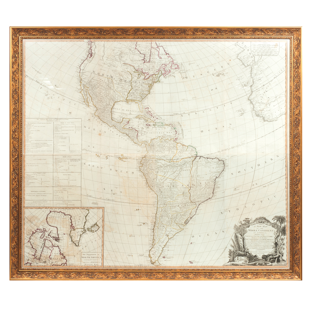
GA - Laurie & Whittle.
A New Map of the Whole Continent of America, Divided into North and South and West Indies.
London: Publish'd by Laurie & Whittle, 12th. May 1794.
Mapa grabado, límites coloreados, 103 x 119 cm., dividido en dos partes: Norte y Sur.
Wherein are exactly described the United States of North America, as well as the several European possessions according to the preliminaries of peace signed at Versailles Jan. 20, 1783. Compiled from Mr. D'Anville's maps of that continent with the additions of the Spanish discoveries in 1775 to the north of California & corrected in the several parts belonging to Great Britain from the original materials of Governor Pownall, M. P.
Muestra a Estados Unidos de América delimitado al norte con Canadá y al sur con el Rio Mississippi. Tabla en margen izquierdo: "The Continent and Islands of America are Divided and Possessed as follows viz"; debajo se encuentra un recuadro con mapa: "The Supplement to North America" de Hudson y Baffin's Bay; en esquina inferior derecha se encuentra un cartouche decorado con flora y fauna.
Enmarcado.
Originalmente dibujado por John Gibson en 1763 "An accurate map of North America", y aumentado con base en la cartografía de D'Anville y las expediciones españolas realizadas al norte de California en 1775.
Estimado $40,000-45,000
|