|
Subasta 710, Lote # 251 G - Williams, J. J.
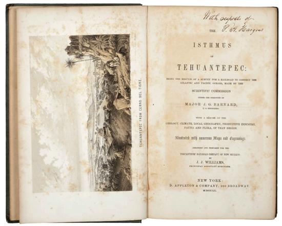
The Isthmus of Tehuantepec / Maps Illustrating the Isthmus of Tehuantepec.
a) The Isthmus of Tehuantepec.
New York: D. Appleton & Company, 1852.
4o. marquilla, 295 p.
Being the results of a survey for a railroad to connect the Atlantic and Pacific oceans made by the scientific commision under the direction of Major J. G. Barnard.
With a resume of the geology, climate, local geography, productive industry, fauna and flora of that region.
Illustrated with numerous Maps and Engravings.
Con 14 laminas, un mapa y un cuadro plegados.
Encuadernado en pasta dura.
Palau: 375712.
b) Maps Illustrating the Isthmus of Tehuantepec.
New York: D. Appleton & Co., 1852.
1.- Map of the Isthmus of Tehuantepec...
2.- 1851 Tehuantepec Survey...
3.- Sketch of the Mouth of the Coatzacoalcos River 1847...
4.- Tehuantepec Survey...1851 (con inclusos de 2 ciudades, una de ellas Minatitlan).
5.- Mouth of the Coatzacoalcos River... 1848...
6.- Map of the ports of Laventosa and Salina Cruz...1852 (by Trastour).
7.- Plan of that part of the Isthmus of Tehauntepec between the Jaltepec River and Pacific Plains....
8.- Chart of the Entrance and Channel of the Boca - Barra...1850 (by Trastour).
Detallados mapas tipográficos preparados bajo la dirección del Mayor J. G. Barnard.
Ingeniero en Jefe de la Compañía del Ferrocarril de Tehuantepec, de Nueva Orleans, Louisiana. Una propuesta, en respuesta al otorgamiento por parte del Gobierno Mexicano de concesiones a compañías extranjeras para construir un tren de 192 kilómetros de longitud, para atravesar el istmo de Tehuantepec, en la década de 1850. En 1882, el gobierno Mexicano decidió construir el tren por cuenta propia, pero no se termino hasta 1907 bajo contrato Británico.
Contenidos en cubiertas en pasta dura en tela original grabada, títulos en dorado.
Total de piezas: 2.
Estimado $9,000-11,000
|